
In order to support planning initiatives in the country and help imagine the future landscape, Bengal Institute conducts studies at regional and urban scales with multidisciplinary teams of national and international experts.

Tomorrow’s Bangladesh is already here. Achievements and progress in all fields—from manufacturing to cricket, and from architectural excellence to social indicators—open up new prospects and promises for Bangladesh. PricewaterhouseCoopers, in its global economic projection for 2050, estimates that Bangladesh can potentially become the world’s 28th largest economy by 2030, surpassing countries like Australia, Spain, South Africa, and Malaysia in economic growth.
But there are also challenges when things move rapidly. As economic and social transformations are ultimately related to realisations on the ground, on impacts to the physical and infrastructural landscape, a robust and integrated planning is required to deal with changes. We are reminded of Bangabandhu Sheikh Mujibur Rahman’s call for a “comprehensive planning… rather than doing something today, something else tomorrow, and something else day after… which will not solve problems” (1972). Planning at such a scale requires embracing a new imagination as conventional ones are not enough to deal with the enormity of changes.
In visualising the future, we need an adjustment of the mental map of Bangladesh. A nation is not only narrated and officiated but also visualised; visualisation provides powerful perspectives for re-viewing the nation. The research and design team at Bengal Institute presents here a possible outline of that new map.

While the Bangladesh government, and its different ministries and agencies, as well as some international agencies, have proposed bold ideas and schemes in various documents (especially the government Seven Year Plan), our future map adopts some of those ideas, includes additional ones, and presents them as an integrated image so that its starts to circulate in the national imaginary.
Water will remain the raison d’etre of Bangladesh. A hydrological thinking should be the foremost basis for a new imaginary, and consequently any planning action in Bangladesh. Bangladesh is a unique chemistry of land and water. It is not all about land, but land and water. Bangladesh is not only deltaic, it is also estuarian. We have only imagined a riverine Bangladesh—Bangladesh can also be re-visioned as also being oceanic.
A hydrological consciousness will provide a fuller understanding of the dynamics of water—its flows and counterflows, and its deep implications in the economic, ecological and life-world of the people. Issues of climate change are intimately connected to the realm of water. If sustainable development is to be treated seriously, in Bangladesh it ought to be begin and end with water. As Prime Minister Sheikh Hasina has clearly directed: water needs to flow, silt managed with new initiatives, and riverbanks planned with new ideas.
While the economy has become the most powerful parameter of national development, economic drivers must align with ecological imperatives and life-world conditions. Land strapped, on the one hand, and demographically challenged, on the other hand, Bangladesh requires the planning and management of every square inch of its territory. A new physical planning is needed that redefines the territory of the nation, and frames new regional formations advancing the potential of each region.
What is needed, next in scale to the region, is a re-visioning of settlement and landscape patterns, and preparing a national agenda for an urban future. We have to admit that while Bangladesh maintains a rural ethos, it also has become a “country of towns.” New visions for cities and towns require standpoints on where should cities be, what should be the footprint of each city, what should be its civic constituents, what should be the population, how it should relate to agriculture and flood-plains, and how each one can be consolidated with its own potentials, growth spurs and connectivity to neighbours. Similar questions should be asked for settlements at any scale, from the very rural to the semi-urban.
Development of a country cannot be based only on five or ten-year plans. “To envision the future,” as Abul Khair, as chairman of the executive board of Bengal Institute insists, “a hundred-year plan is needed.” Pointing out Prof Abdur Razzaq’s truism that a developmental imaginary for Bangladesh will have to consider three resources—land, people and rivers—Abul Khair adds culture and tradition to it.
With maps and diagrams, we offer summary points for the imagined future.

RETERRITORIALISING BANGLADESH
An achievement of the present government, rearrangement of Bangladesh’s international waters unleashes new possibilities, and encourages us to revise the understanding of the map that has so far prioritised land territory. With the opening up of an oceanic territory into the Bay of Bengal, new settlement, economic and transport opportunities are possible with a marine vision. We strongly support the 7th Five Year Plan (2016) that presented the value of a “blue economy” based on an oceanic scenario. While a prospect of that magnitude requires a huge infrastructural and planning investment, there is no reason to hesitate in slowly going into the seas.
Bangladesh is a terrain of water. From ancient to contemporary times, the presence of water in the form of rivers, canals and various water bodies has been inscribed in the imagination and practices of the people. The terrain should now be expanded. Riverine Bangladesh should flow into the imagination of an Oceanic Bangladesh. The Bay of Bengal can be the new frontier of Bangladesh offering a new and vast terrain of inhabitation, productivity and opportunity.
SETTLEMENTS SHOULD BE REIMAGINED
Utilising sedimentation in the Bay (700 million tons deposited annually at the mouth of Meghna estuary), we can imagine a new coastal landscape for Bangladesh that expands its territorial dimensions. We imagine an “archipelago of sea-towns” on artificial shoals and islands, and other constructed platforms, connected by causeways. While this will require massive infrastructural and investment input, and consideration of marine ecology and complex oceanic dynamic, this may be conceived through a careful combination of landfill, and offshore, floating, hybrid, and submerged structures. Construction of sea barrier walls can work as buffer against tidal surges and tsunamis.
An archipelago of sea-towns will be a uniquely constructed landscape hosting major industries and economic zones, with proper housing and urban amenities, as well as facilities for marine fishing and processing. Major port facilities may be installed there, perhaps with Payra as a hub of this projected development. It will be possible to install energy production hubs there utilising the environmental conditions of the sea. As part of the national initiative to face climate change, the constructed islands can be adaptive mechanism to face sea level change. In a landfill process, waste from the mainland can be collected and placed on artificial islets after proper processing (similar to Singapore’s offshore landfill Semakau).
There are many examples of sea-based developments. Seasteading Institute has been advocating a sea-faring society, Singapore has land-fill projects in the sea, Florida has numerous sealinks through its marine islands, the Dutch are building a seawall with new town development in the seas off Jakarta, and of course, half of Netherlands is built on the sea.
RIVERS CAN GENERATE NEW POSSIBILITIES
Bangladesh is a land of liquid flows, dominated by the dynamics of riverine ecosystems made of rapidly moving and slow-moving waters, and areas of inundation. While the flow is generally towards the Bay, other complex forms of flows and overflows determine more localised conditions, and together create the character of the extensive delta system. Resilience and sustainability of the country undoubtedly depends on an intelligent but delicate management of the riverine ecosystem.
Silt—a production of river flows—is liquid land. Silt management rather than river management, should be a non-stop process with modernised, mechanised methods. Bringing more depth to rivers and canals by dredging, new riverbanks may be created by silt deposits.
Rivers as natural infrastructure remains as major lines of communication but can become more active and effective with better river management, shoreline planning, and modern water vehicles. If most cargo movement happens on rivers, roads may become freed from trucks and other vehicles. With modernised river dredging and planned silt depositing, shorelines can be planned for new habitation and architectural typologies, riverside forestation, and commercial setups. As the prime minister presciently noted in a recent meeting, this opens up new land opportunities that do not exist now.
ENERGY INNOVATION IS A NECESSITY
Energy will continue to be a critical factor in elevating Bangladesh towards a new economy, and maintaining that position. While conventional energy sources will remain, it is also time to consider newer sources, most desirably renewable ones. Energy from solar, wind, and other methods need exploration at a large scale. Again, a coastal/oceanic territory offers opportunities in harnessing newer forms of energy. With the oceanic landscape as the site, battery of energy producing hubs or farms may be constructed harnessing solar and wind conditions, and tidal wave movement or sea current.
Based on a study of working examples elsewhere, we calculate that one acre of solar farm may yield 145 MWh of electrical energy. Similarly, an acre of wind farm but based on a larger setup may yield 139 MWh, while a tidal barrage with an enclosed reservoir of 5000 acres may produce about 90 MWh per acre.
DISTRIBUTED URBANISM
In a country where land is scarce, we have to be inventive in creating spaces of habitation. A consolidated national plan is required to tame and manage the wild urbanisation that defines the current process. An immediate need is to decide on and configure the settlements patterns as they impact the footprint of development, and form a disruptive relationship with agricultural land (affecting food security), wetlands and floodplains (impacting ecological and bio-diverse conditions). While we give more attention to metropolitan centres in our urban discourse, a similar attention is needed for smaller towns and other aggregations.


A key issue in tomorrow’s Bangladesh will be the state of urbanisation and housing the extra population expected by 2040. Planned agglomeration and distribution of future population will be critical for a sustainable economic and social development. Population projection puts the urban population at 83 million in 2041 (BBS), almost double of the current 44 million (BBS). At present, Dhaka city alone hosts 16 million people, with a density of 50 thousand per sq km. If the current trends of Dhaka-centric development continue in 2040, the city will have to accommodate another 30–35 million people. Chittagong, the next big city after Dhaka, has a population of 2.5 million with a density of 16000 per sq km. No other divisional headquarters has a population over 0.6 million (except Khulna).
For a balanced development, Bangladesh will need to have “metro cities” beyond Dhaka which can absorb the extra population. By 2041, we can plan for 7–8 metro-hubs with 5 million each, 10 medium cities with 1 million plus each, and 40 smaller towns with 0.5 million each. Each of the metro cities, including Dhaka, can have a networked region composed of small and medium cities and villages in-between.
Being a country with a huge population in a small geographic boundary, Bangladesh needs to have cities with high density. Density, often cited as the culprit for urban ills, is not a factor in creating such liveable, walkable places such as Mong Kok in Hong Kong with a density of 130,000 people per sq km.
Population and density are associated with the footprint of settlements. For future redistribution of population, the metro cities can have a density of 20,000 per square kilometre that will require a footprint 250 sq km (for a total population of 5 million). The medium and small cities can have density of 10,000 and 8,000 with areas of 100 sq km and 60 sq km respectively.
ECOLOGY CAN BE PART OF A DEVELOPMENT STRATEGY
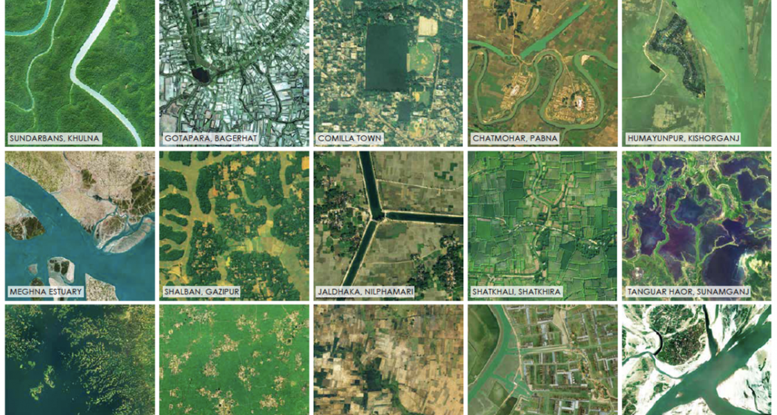
Ecological sustainability can be an ally to economic drivers. Despite its small territorial entity, Bangladesh is a land of geographical diversity. While the predominant narrative is around river kissed flood plains, there are unique hills, haors and forests.
Ecosystems are not abstractions; they provide actual and real values to its human inhabitants. Each ecological zone has both economic and existential values providing a unique and rich source of life-sustaining materials (see An Atlas of Landscapes). Any national development that disregards the complex, multi-dimensional ecosystems will produce a fragile, short-sighted scenario.
Ecological processes can be created or jump-started. An exemplary possibility is char forestation. Char-lands cover approximately 6 percent of the total land area of the country (CEGIS, 2000). On the other hand, Bangladesh has a forest area of about 11.2 percent of the total area of the country (ADB, 2016). Between 1990 and 2010, the country has lost 840,000 hectare of forest cover at a rate of 42,000 ha per year (FAO). At least 25 percent forest cover is essential for maintaining biodiversity and ensuring ecological goods and services, such as clean air, clean water, carbon sequestration, and flood control in a country. As a result, Bangladesh is in dire need of increasing its greenery in order to achieve environmental sustainability. An increase in forest cover can happen through afforestation, reforestation and natural expansion of forests. Chars that are not eroded in the first four years of their emergence could be used for forestation, cultivation or settlement, and a renewed functioning of the ecosystem.
NEW REGIONAL FORMATIONS CAN TRIGGER ECONOMIC DIVIDENDS
Redefined regions can be the basis for development strategies for economic investments, urban clustering, and landscape management. Bangladesh is already formed by regional varieties defined by geographic and cultural distinctiveness that is often aligned with administrative boundaries. New urban clusters—conurbations—may be planned according to the economic and ecological potentials and conditions of each region.
“Dhaka Nexus” is a proposed regionalisation of Dhaka and its surrounds that reorganises the ensemble of towns and settlements in a two-hour or less travel distance around Dhaka, along with a revision of transport network. The goal of Dhaka Nexus is to deflect singular attention on Dhaka city, and decongest it. Other regions may be imagined that also deflect attention away from Dhaka, but more importantly heighten the potentials of those regions. We imagine the following regional formations around towns upgraded as “metrohubs,” each one according to its new regional potential: Chittagong, Rangpur, Khulna, Rajshahi, Sylhet, Mymensingh, Comilla and Barisal.
Digitisation and electronic network is the new reality, the properties of which are going to expand exponentially. Regionalisation and new clustering of towns will become effective with adoption of various digital services (in education, recreation, and employment), and which will not require frequent travel to the metropolitan centres.
NODES AND ROADS FORM AXES OF DEVELOPMENT
A transformation of settlement patterns requires an equally robust overhaul of the national transport system. People are now moving more than ever, from one town to another, from one region to another, and even from the nation to the beyond. Movement of goods remains the backbone of the economic dynamic. Existing networks of movement—rail, road and river—need to be reorganised, augmented, and transformed. While all these involve long-term engagements, our point is to consider them in the future physical planning of Bangladesh.
We imagine two major north-south transport axes running the full length of the country: the Rangpur-Payra Axis, and the Sylhet-Cox’s Bazar Axis. An east-west link may be imagined connecting Sylhet and Bogra via Mymensingh, one that is non-existent now. Cross links connect other cities and towns. A river-sea link may connect Dhaka and Chittagong via Barisal. Transnational axes of movement may link different points outside the country. With rivers as a pre-existing infrastructure and after being dredged, they can become major arteries for cargo movement lessening the load on road traffic.
Tourism, a very under-performing sector, can benefit from transport developments. With Bangladesh’s rich tapestry of landscapes and warm confluence of traditions, international tourism can be a highly profitable enterprise if organised with national planning of tourist nodes and transport corridors.
PLANNED HABITATS AND FOOD SECURITY ARE RELATED
Bangladesh has made great strides in food production, but at the same time arable land has decreased from 73 percent in 1989 to 59 percent to 2012 (according to FAO). In our over-zealousness to develop metropolitan infrastructural spectacles, let us not forget food security for the nation unless we want to fashion ourselves as a service economy like Singapore or Dubai. Additionally, climate change may affect the complex, diverse and sensitive ecosystems that are foundations of food production.
Planned agglomeration of habitats, settlements and industries with precise footprints need to be determined, with releasing rest of land for agriculture, as well as hydrological flows. Traditional land division and homestead distribution have not helped in consolidating productive land. Consolidation of villages can provide cohesive communities, concentrated services and utilities, efficient roadways, and open up land for large-scale agricultural and fish cultivation.
Consolidation of villages may allow creating new social, informational and cultural hubs.
With Bangladesh’s 80,000 villages, Abul Khair imagines such a hub for a cluster of four villages. Each hub on a 15 bigha land may have playfields and clubs to cater to drama, music, and other recreational activities. In the towns, many of the old movie halls may be mobilised as new cultural hubs.
Research and design were directed by Kazi Khaleed Ashraf and Saif Ul Haque with Masudul Islam and Nusrat Sumaiya and team at Bengal Institute. Team members who contributed to these features are: Tazrin Ahmed, Dhrubo Alam, Muntakim Haque, Maria Kipti, Rifat Ara Mostafa, Rubaiya Nasrin, Mahmudur Rahman Rafat, Arfar Razi, Afreen Ahmed Rochana, Sumaita Tahseen, and Zarin Tasnim.